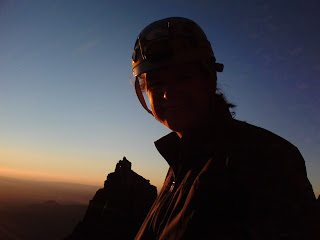
On August 11 & 12 Rick Barry led an attempt on North Sister(Leader assist: Jay Avery.) Unfortunately we were getting blown over as we neared the summit and had to retreat. Climbers: Jay Avery (Leader assist) Robyn Smith, Mike Mchugh, Bryon Snapp, Mike Niemeyer, Bill Langdon and Kirk Kraschel. You can see the lenticular cloud build over South Sister in these two pictures (below)- one sign of the high winds we were experiencing.
From Rick's prospectus: Leader: Rick Barry; . Total distance: approximately 16 miles round trip; Elevation gain: 4785’ .
Driving directions: From Salem follow Hwy 22 until it merges with Hwy 20 and continue east over the Santiam Pass to Sisters. From the town of Sisters, drive west on Mckenzie Highway (state highway 242) about 1.6 miles to Pole Creek Spring Road (USFS 15). Follow USFS 15 and USFS 1524 almost 11 miles to a parking area and trailhead. This is a heavily used trailhead and there are fairly accurate signs leading to Pole Creek.
Getting to high camp: Follow Pole Creek Trail (USFS trail 96) 1.9 miles to the junction with Chambers Lakes Trail (USFS trail 96B) at Soap Creek. Turn west at the junction and follow Chambers Lakes Trail about 1.5 miles. Where the trail opens out into a small clearing, turn right and follow a climbers’ trail west up an intermittent creek. About 30 minutes hiking leads to timberline. There’s a fairly obvious high camp in this area which will put us right at the base of the South East Ridge.
Route description: Our high camp puts us a few hundred yards south of our ridge. From camp we’ll immediately gain the ridge. From here we’ll turn west and begin a nice scree slog up to the south ridge. Here we’ll turn north and continue the slog for another ½ hour or so until we reach the traverse. The traverse is a steep slope comprised of loose dinner plate rock with fair exposure. Here we’ll put in a fixed line using what decent rock is available (not much unfortunately). At the end of the traverse (about 200’ across) we’ll turn sharply to the right and ascend a steep gully; the ‘Bowling Alley’. The Bowling Alley is a moderately steep (60 degrees or so) gulley which continues up about 100’ to an obvious repel anchor. The climbing is a relatively easy 4th class scramble but the rock here is pretty bad. As the name suggests, the real danger is falling rock, mainly kicked down by fellow climbers. With a group of this size that will be an issue so we’ll again put in a fixed line and climb as carefully as possible. We’ll group up at the top of the Bowling Alley to minimize rock fall hazard on those bellow. From the repel horn it’s a short scramble to the top over surprisingly good rock. We’ll pull our second fixed line so that we can repel back down to the traverse.(Click to enlarge pictures)